They Have the Solutions – You Have the Business!
Calling INTERGEO Visitors, interested Parties, and Investors to
Meet innovative Start-ups with space-related Business Cases
The Bootcamp of the 2019 Copernicus Accelerator will take place during the INTERGEO on 17 -19 September 2019 and finalises the 2018/2019 edition.
50 young and promising start-ups with innovative business cases, concepts and services have the chance to present their products to you. When you are a Visitor, interested Company or Investor:
Take the chance to meet up with the next generation of space-related start-ups and support their growth!
Arrange one-to-one meetings with these start-ups now!
Meanwhile, get a sneak-peek of who will be presenting their business cases on INTERGEO 2019:
2019 BOOTCAMP PROGRAMME
Join us on 17 – 19 September 2019 at the INTERGEO in Stuttgart, Germany!
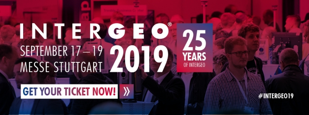
You can find the 2019 Copernicus Accelerator mentees in Hall 4, Booth D4.006. The Opening Session and live pitches of these mentees will take place on the INTERGEO stage. A detailed programme overview will follow soon.
Tuesday, 17 September 2019: Exhibition and business speed-dating (1-to-1 meetings) with 16 exclusive mentees.
Wednesday, 18 September 2019: Exhibition, 3 breaks with networking opportunities, 2 business speed-dating sessions, 2 pitching sessions and evening reception with all mentees.
Thursday, 19 September 2019: Exhibition and business speed-dating (1-to-1 meetings) with 16 exclusive mentees.
You can book 1-to-1 meetings with our mentees on the above dates via B2Match.
You will need to register to the INTERGEO in order to get meet the 2019 Copernicus Accelerator mentees.
Registration is now open, early-bird tickets are available until 8 August 2019.
EXCLUSIVE BOOTCAMP FEATURES
![]()
PROMISING START-UPS
![]()
EXCLUSIVE ATMOSPHERE
![]()
PROMOTION
![]()
ACCESS TO THE EO NETWORK
![]()
INVESTMENT OPPORTUNITIES
LIST OF MENTEES 2019
- Mr Alan McLarney
RelyMap - Cloud based service analysing the urban impact on GNSS services to aid in the development of smart cities and infrastructure
- Mr Alejandro Carbonell
Celsius - the reduction of effects of the temperature in cities
- Mr Alexander Gunkel

- Ms Aneta Ruzik and Ms Katarzyna Lenart
VINUM 4.0 - A system for selecting the best location for setting up a new vineyard
- Ms Annett Frick and Mr Sascha Gey
BirdWatch - The Diversity of Life from Space

- Mr Aschwin van der Woude
UrbanZee - We create impact on air quality through collaboration

- Mr Bastian Kubsch and Mr Michele Bandecchi
SMART CLOUD FARMING - Cloud based AI platform, digitising soil knowledge and create 3D soil maps to boost regenerative agriculture practices

- Ms Cassi Welling
Air Quality Intelligence for Smarter Mobility Planning - Digital air quality management system for the urban hub, fusing satellite and geospatial data with IoT sensors to create hyperlocal insights and tools to reduce traffic & other pollutants
- Mr Conrad Bielski
Global Asset Risk Monitoring - Service providing standard geospatial risk products to your global locations for tailored solutions such as supply chain management

- Mr Daniel O'Connell

- Mr David Jones
Sandbag - Measuring big polluters from space

- Ms Devleena Bhattacharjee
QresQ - QresQ helps authorities save lives and livelihoods proactively. We use a mix of geospatial and digital media data to provide a dynamic dashboard for monitoring and mitigating natural disasters and humanitarian crisis happening across the world

- Ms Elisa Erioli, Mr Sebastiano Pratellini and Mr Silvio de Colle
scubascubadoo - Whether you dive or you swim, you better choose your place from the space using ScubaScubaDoo app

- Ms Eloise Marais
Tool for Recording and Assessing the City Environment (TRACE) - A data transformation and interpretation service that converts large and cumbersome EO into valuable information about air quality in cities

- Mr Erik Seume
AConInsight - Air contamination insight for industrial applications
- Mr Filip Rojs
GMS-GIS for Insurance and GMS-GIS Flood Mapping Module - Location intelligence and remote sensing for the insurance industry

- Mr Filippo Iodice, Mr Mario Monaldi and Mr Matteo Perrotta
UptoEarth - Carbon sequestration in agricultural soil

- Ms Francesca Larosa
BalanceShift - BalanceShift provides multinational companies with short-term and long-run assessment of the climate risk they face along the whole supply chain. This is assessed with an impact model that translates climate into location-specific and asset-explicit economic damages
- Ms Francesca Pietracaprina
EDEN - Tackle the problem of risk estimation of soil degradation

- Mr Gregory Mygdakos

- Mr Indra den Bakker and Ms Anniek Schouten
Forest Health Monitoring - The 20tree.ai Forest Health Monitoring solution leverages the latest advancements in satellite imagery and artificial intelligence to monitor forest health and disturbances such as drought and insect infestation

- Mr Christos Tsatsoulis
SATSHIPAI - Enhancing maritime surveillance with satellite data and Artificial Intelligence (AI)

- Mr Isaac Dura
Marine Big Data Analytics - AI Cloud service, leveraging the possibilities offered by marine Big Data to provide market and scientific analytical insights to users
- Mr Jeffrey Wallace
LifeLine - LIFELINE functions as a voice activated AI lifestyle assistance and safety monitoring system for the elderly and disabled that features mobility-as-a-service (MaaS) using advanced GNSS capabilities and Copernicus data in the background for mobility impacts and planning, wellness impacts and lifestyle
- Mr Jingyao Su
GoShip - Smart marine routing service, based on GNSS and Copernicus, providing maritime safety evaluations and real-time optimised navigation for ocean travels

- Mr Gatis Bolinskis and Mr Juris Sinica-Sinavskis
Dynland - Self-learning land cover recognition for Earth observation and decision making

- Ms Kerry Phillips
Sub Terra Intelligence - Terra Intelligence is using artificial intelligence algorithms to automatically observe resource mines using earth observation satellite images, as well as to determine trends in resource output and storage, which is then provided as business intelligence to market players
- Mr Louis Baron von Freytag-Loringhoven, Mr Karsten Wiertz, Mr Jan Kolmas and Mr Sebastian Bußmann
SuperVision Earth - Gas infrastuctures monitoring using space images

- Mr Luca Brocca and Mr Paolo Filippucci
SPACE-IRR - Measuring irrigation from space through high-resolution Sentinel-1 and Sentinel-2

- Mr Mario Castro de Lera
ONEWAVE - Tsunami Verification from Space

- Mr Mattias Nilsson
Fuelcast - The world's first mobile application for ship crew behaviour

- Mr Michał Zachara and Ms Katarzyna Lipka
Deep Flow - AI for data segmentation

- Mr Mohammadreza Sheykhmousa
ReASSESS! - Measuring post-disaster recovery from space!

- Ms Nur Algeet Abarquero and Mr José Luis Tomé
FORESTMAP - The integrated web platform for forest inventories
- Mr Pablo Marzialetti
Silex Clouds S.R.L. - Dust Monitoring Service to support solar energy infrastructures (PV & CSP) in MENA region as real time dust monitoring service, frequency maps, proximity maps, affected areas and forecasting

- Mr Panagiotis Symeonidis
ARtificial Intelligence EO land use temporal Change detection System (ARICS) - ARICS is an Artificial Intelligence driven platform that utilises Sentinel data to detect abnormal land use changes from construction, deforestation or other illegal activities

- Mr Peter Pastorek, Mr Martin Galis and Mr Jozef Nováček
Green Bridges - Modelling of animal migratory corridors for detection, analysis and mitigation of collisions between wildlife and human activities, like traffic accidents and penetration of wild animals into the cities

- Mr Richard Barre
BuildSpot - The service of construction site continuous detection and monitoring
- Mr Robert Heinecke
Breeze Technologies - Breeze Technologies provides hyperlocal air quality and climate data through smart, affordable indoor and outdoor sensors and aggregated other data sources, as well as actionable environmental intelligence for corporates and cities

- Mr Robert Schmitt
Spatial Farm - Eliminating waste in farming with satellite based fertiliser prescriptions

- Mr Robin Bouvier
Cyber Environmental Law Enforcement (CybELE) - Satellite-based investigative services and products dedicated to experts gathering evidence on environmental damages or crimes

- Mr Rolf Schmitz
Linda Forest - Predicting Forest Growth with Satellite Data and Machine Learning

- Mr Roman Bohovic and Mr Jan Labohý
Droughtmeasure - Satellite-based commercial drought assessment service for cities, regions, insurance companies and farmers that will be able to measure real impacts of drought on vegetation

- Mr Carsten Deyl
Sheriff.ai - Sheriff.ai uses computer mouse movements for continuous biometric identification
- Mr Suvrajit Saha
Alladin - Just in time production for farming

- Mr Svante Henriksson
Hurricane Unwinder - Intensity forecast from satellite images

- Mr Taras Matselyukh and Mr Vsevolod Matselyukh
TSAR AI - rapid and precise surface change detection

- Ms Tatiana Suárez
Flightform Insights - Using Remote Sensing - Scientific Interpretation and Artificial Intelligence for Forecasting and Measuring of Commercially Valuable Fundamental Data in Energy

- Mr Tryggvi Stefansson
Myriad - The first commercially viable fully autonomous drone


